Anfahrt mit dem Auto
Aus Richtung Köln/Düsseldorf kommend befahren Sie die BAB 4 bzw. 44 bis zum Autobahnkreuz Aachen. Dort wählen Sie die BAB 4 in Richtung Antwerpen/Heerlen. Nehmen Sie die Ausfahrt Laurensberg und wenden Sie sich nach rechts Richtung Aachen. Nach etwa 1,5 km verlassen Sie die Schnellstraße auf die rechts abgehende Umgehung Richtung RWTH-Melaten/Klinikum. Sie befinden sich nun auf dem Außenring um Aachen. Diesen Ring befahren Sie, bis Sie durch einen Tunnel kommen. Nach dem Tunnel nehmen Sie die unmittelbar folgende Ausfahrt “RWTH-Melaten”. Im Kreisverkehr nehmen Sie die dritte Ausfahrt und folgen dem Seffenter Weg. Biegen Sie die fünfte Straße rechts ab.
Anfahrt mit öffentlichen Verkehrsmitteln
Vom Bahnhof Aachen West
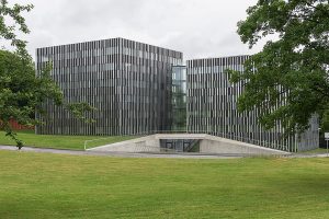
Fußweg (ca. 700 m): Den Bahnsteig verlassen Sie über die Treppe. Diese endet in einer Unterführung, dort wenden Sie sich nach rechts und folgen dem Seffenter Weg bergauf. Sie passieren die Bushaltestelle Mies-van-der-Rohe-Straße und biegen in die zweite Straße auf der linken Seite ein (Kopernikusstraße). Das Gebäude des Lehrstuhls für Bildverarbeitung befindet sich am Ende auf der rechten Seite.
mit dem Bus: Den Bahnsteig verlassen Sie über die Treppe. Diese endet in einer Unterführung, dort wenden Sie sich nach links und gehen zur Bushaltestelle “Westbahnhof”, die Linien 33, 73 und 103 bringen Sie zur Haltestelle Hainbuchenstraße (zwei Stationen). Über die Treppe an der Bushaltestelle gehen Sie geradeaus auf das Gebäude zu.
Vom Hauptbahnhof Aachen
Auf dem Bahnhofsvorplatz stehend gehen Sie geradeaus zur Bushaltestelle. Dort steigen Sie in die Linie 3A ein. Alternativ können Sie auch in die Linie 3B an der Bushaltestelle auf der gegenüberliegenden Straßenseite einsteigen. Die Haltestelle, an der Sie aussteigen, heißt Mies-van-der-Rohe-Straße. Wechseln Sie die Straßenseite und folgen Sie der Hauptstraße (Seffenter Weg) bis zur nächsten Straße links (Kopernikusstraße). Das Gebäude des Lehrstuhls für Bildverarbeitung befindet sich am Ende der Kopernikusstraße auf der rechten Seite.


